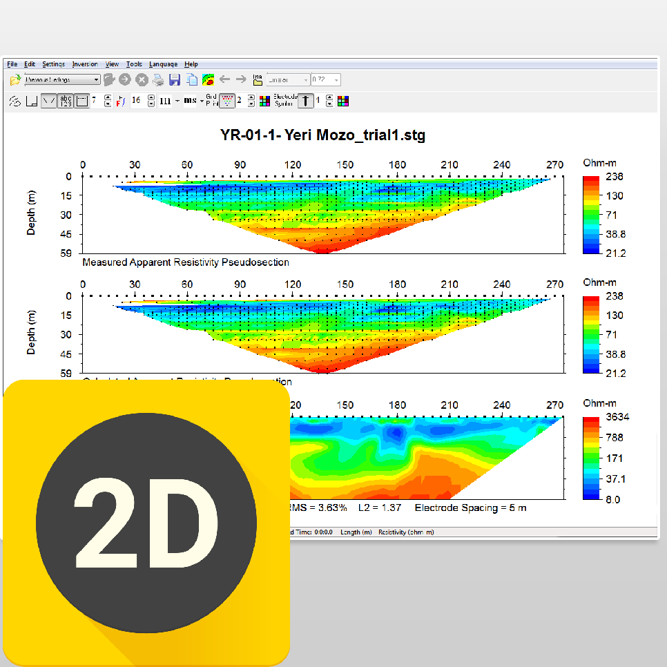
AGI EarthImager 2D is a software package developed by Applied Geophysics Incorporated (AGI) for processing and interpreting 2D resistivity and induced polarization (IP) data collected during geophysical surveys. It is used by geophysicists, geologists, and environmental scientists to create subsurface models and identify potential targets for mineral exploration, environmental studies, and engineering projects.
Key features of AGI EarthImager 2D include:
Data Processing: The software provides tools for processing raw resistivity and IP data, including data filtering, leveling, and correction for instrument drift and electrode effects.
Data Inversion: EarthImager 2D includes algorithms for inverting processed data to create 2D models of subsurface resistivity and chargeability distributions. The software supports both smooth and block inversion methods.
Model Interpretation: The software provides tools for interpreting inversion results and creating geologic models of the subsurface. Users can manually edit models to incorporate geological knowledge and constraints.
Visualization: EarthImager 2D offers visualization tools for displaying raw data, processed data, inversion results, and geologic models. Users can create contour maps, cross-sections, and 3D views of the subsurface.
Integration: The software can import data from a variety of geophysical instruments and formats, allowing users to process and interpret data collected using different survey techniques and equipment.
Report Generation: EarthImager 2D includes tools for generating reports and graphics to communicate survey results and interpretations to clients and stakeholders